Boyse Park
Planned Project - This project is in the long-term plan for Ridgefield but is not currently in Active development.
Boyse Park is a 9-acre neighborhood park with a pump track located off of N. 32nd Avenue that sits alongside a tributary of Gee Creek. The park also includes informal foot and mountain bike trails.
Project Background
The City of Ridgefield purchased the park land in 2020 and 2021. In order to gauge community needs and wants for the land, the City collected public input from our community stakeholders via a community survey from August 5 to September 2, 2022.
The feedback collected in this initial survey was used to develop a Master Plan concept which was presented to the Parks Board for feedback. Additional community feedback on the Master Plan concept was collected from March to June 2023. Some of the amenities included in the initial Master Plan were: picnic areas, pickleball courts, a pump track along with restrooms and off-street parking. The concept Master Plan was presented to City Council on Thursday, April 13, 2023. Council requested revisions and continuing to gather public input on the draft.
On June 8th, 2023, Council was presented with a revised draft Master Plan. Some key changes included moving the picnic areas closer to the parking lot and connecting loops and trails to other regional trails. After reviewing the revised concept and the community input collected via survey, City Council approved the revised Master Plan with one change - removing the pickleball courts from the conceptual design. The approved design concept includes a parking area, restroom, trail connections, pump and jump tracks, picnic areas, landscaping and street improvements.
Phase 1 construction, which included a pump track, parking lot and park fencing, was completed in early October 2025. Some additional features will be added during winter 2025-2026.
Future phases are anticipated to include restrooms, pump track expansion, passive recreational area, covered picnic shelter, and pedestrian trail connection to the creek. Design and construction of future phases is contingent on funding.
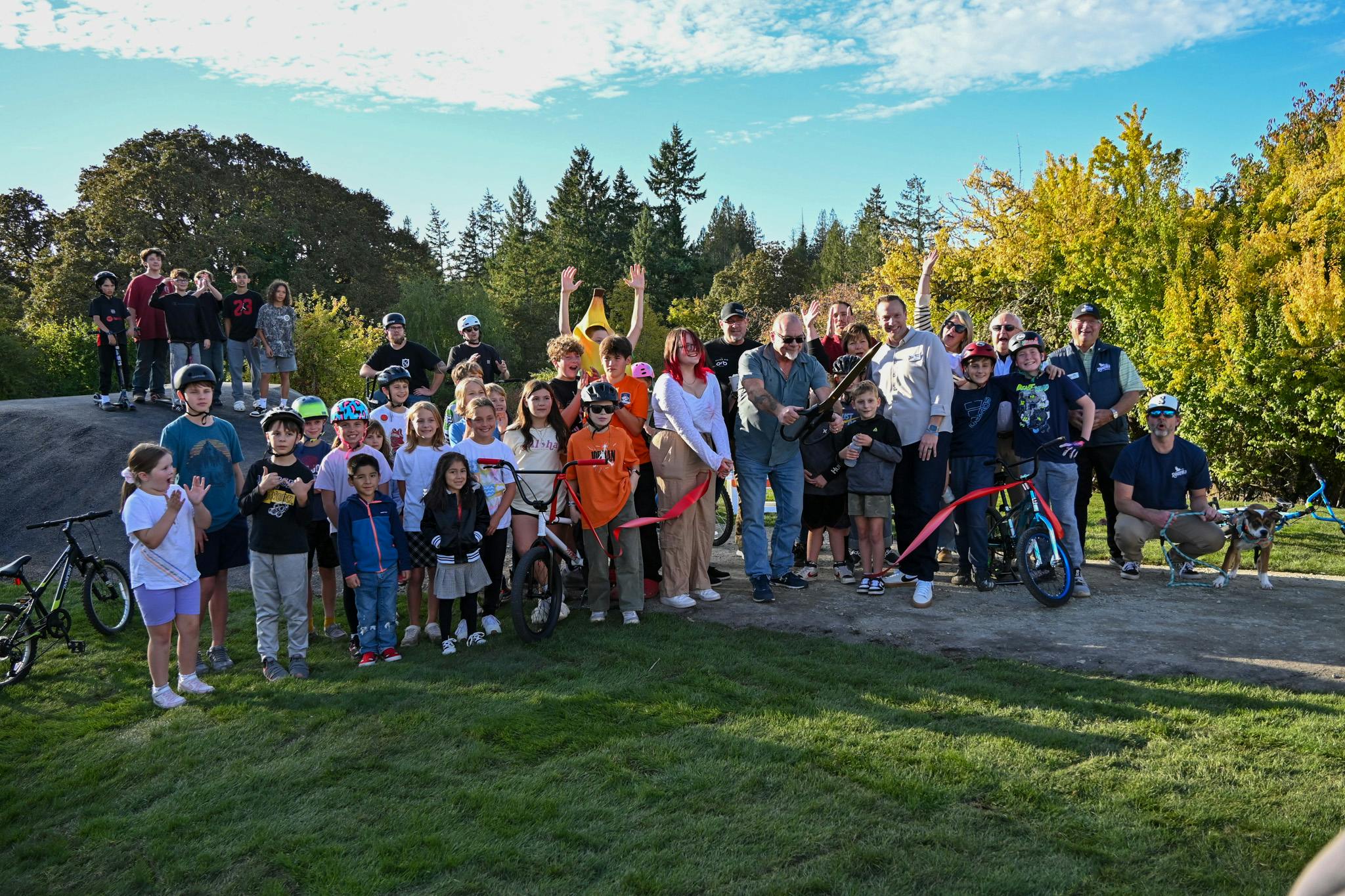
A special thank-you to the Boyse family, who sold their land to the City so it could become a public park for all to enjoy.
Planned Project - This project is in the long-term plan for Ridgefield but is not currently in Active development.
-
Pump Track is OPEN!
Share Pump Track is OPEN! on Facebook Share Pump Track is OPEN! on X (formerly Twitter) Share Pump Track is OPEN! on Linkedin Email Pump Track is OPEN! link
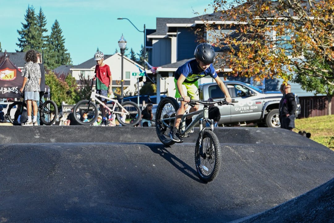
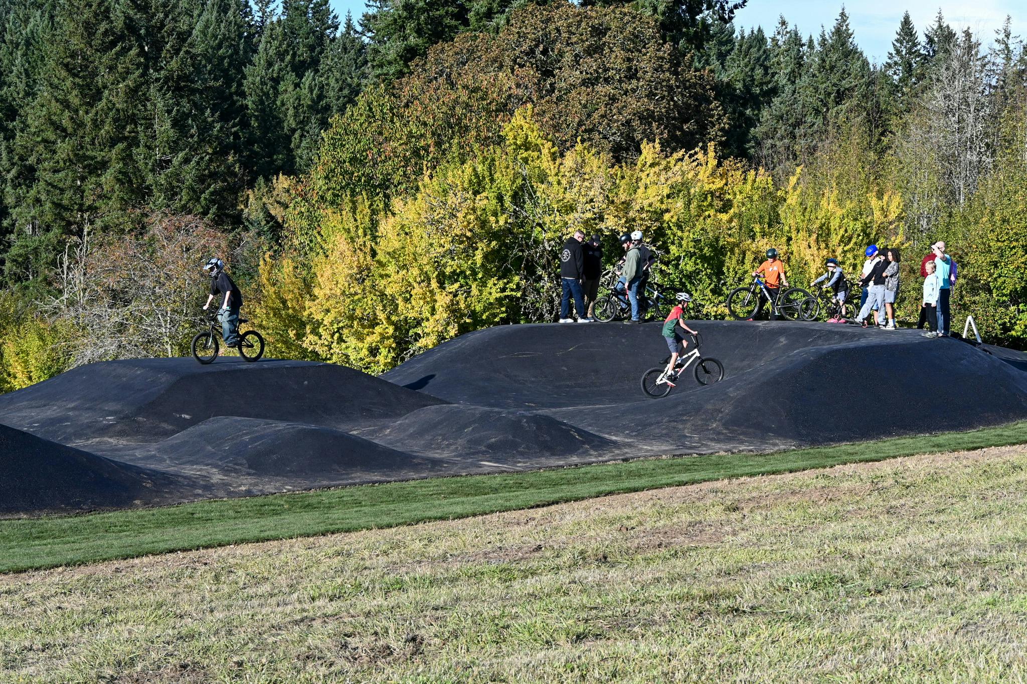
The Pump Track at Boyse Park is OPEN!
This week we celebrated the opening of Ridgefield’s brand-new pump track at Boyse Park (905 N 32nd Ave), the first completed feature in this 9-acre neighborhood park! This exciting addition lays the groundwork for future park improvements.
A pump track is a looping course where riders use body movement, rather than pedaling, to gain and maintain speed. Designed for riders of all skill levels, the Boyse Park track features berms, rollers, and turns for a fun, flowing ride.
The track is open dawn to dusk. A small parking lot is available at the north end of 32nd Ave. Motorized vehicles are not permitted on the track.
A special thank-you to the Boyse family, who sold their land to the City so it could become a public park for all to enjoy.
Planned Project - This project is in the long-term plan for Ridgefield but is not currently in Active development.
-
Master Plan
Share Master Plan on Facebook Share Master Plan on X (formerly Twitter) Share Master Plan on Linkedin Email Master Plan linkThe Master Plan (below) was approved by City Council on Thursday, June 8. Some of the amenities included in the Master Plan are: picnic areas, a pump track along with restrooms and off-street parking. The concept and a descriptive list of amenities may be viewed below.

• Environmentally Sensitive Areas.
The park property includes a creek, wetlands, and Environmental Constraints Areas as identified by Clark County maps. These habitat rich areas include many large native Oaks, Cedars and Douglas Fir trees. Shrubs, flora and fauna are plentiful throughout the northwest area of the site. Conservation of these habitats is anContinue reading
Planned Project - This project is in the long-term plan for Ridgefield but is not currently in Active development.
Photos


Park Location
Boyse Park is located off N 32nd Avenue north of Pioneer Canyon Dr. See the map below for the park boundaries and location.
